Communities across northern and north-western Namibia continue to contend with repeated, sometimes devastating, inundation as seasonal rains swell rivers and render roads impassable. The Namibian’s briefing of current events highlights a pattern of acute local impacts layered on long-term climatic vulnerability that leaves farmers, travellers and emergency services under recurring strain. (This paragraph draws on reporting and regional context.)
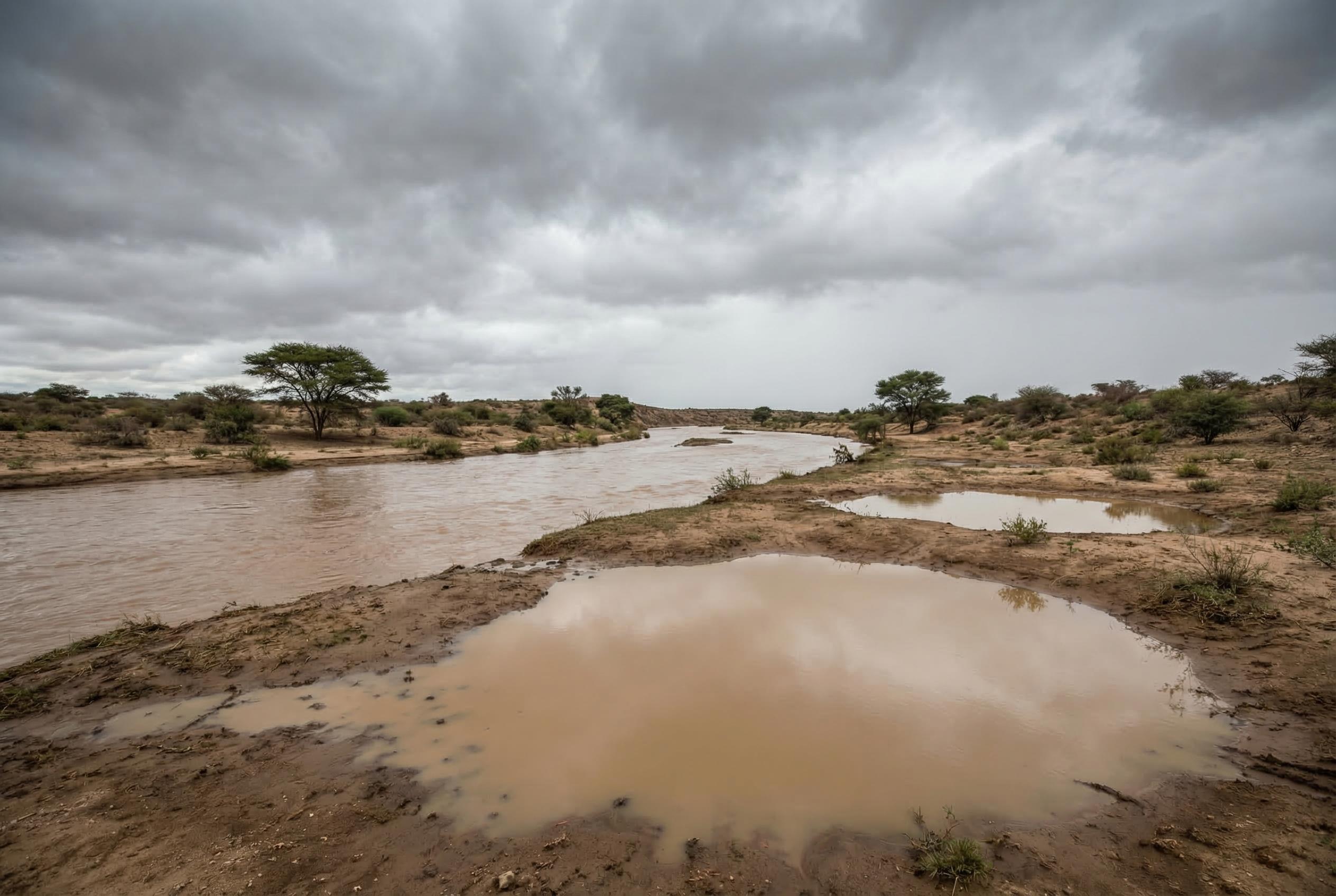
In Kunene Region, authorities over the 2025 rainy season warned residents against attempting to cross swollen rivers after heavy precipitation left many routes unusable and, in some cases, led to drownings and vehicles being swept away. Local police urged people to wait for water levels to fall before attempting crossings, noting that watercourses such as Okangwati, Etanga, Oute, Onungurua and Otjiumuhaha were running high and that fatalities had been recorded near Opuwo and at Farm Lekkerwater.
Further east, heavy downpours in early 2026 produced flash floods in the Zambezi area that submerged arable land shortly before harvest, severely damaging livelihoods in constituencies that include Katima Mulilo Rural and Linyanti. Namibia Meteorological Services data forecasting unusually large seasonal totals , greater than 300mm between January and March in affected zones , compounded the threat to smallholder farmers, some of whom reported losing entire fields to standing water.
The current spate of damaging floods is part of a well-documented regional history. Major episodes dating back decades, including large-scale floods in 2009 that affected multiple countries and earlier seasonal inundations visible in satellite imagery, show how transboundary rivers and low-lying basins repeatedly turn into temporary lakes, isolating settlements and inundating crops. Relief agencies and governments have previously mounted large-scale responses to these events, underscoring the scale such floods can reach.
International and national bodies tracking disaster risk stress that Namibia faces a dual challenge of drought and sudden flooding, with tens of thousands of people affected by extreme events in recent years. Basin-specific dynamics, such as those in the Cuvelai-Etosha system and the Zambezi-Kwando-Linyanti area, mean that some communities oscillate between water scarcity and destructive excess within short periods, increasing food insecurity and eroding resilience.
Local officials and meteorological services continue to issue precautionary guidance: avoid crossing flood-swollen rivers, delay travel until waters recede, and prepare for crop losses where fields are inundated. The combination of immediate public-safety messaging and longer-term investments in early warning, flood monitoring and adaptive agricultural practices remains central to reducing harm as the region faces further hydrological volatility.
Source Reference Map
Inspired by headline at: [1]
Sources by paragraph:
- Paragraph 1: [2], [6]
- Paragraph 2: [2], [4]
- Paragraph 3: [3]
- Paragraph 4: [5], [7]
- Paragraph 5: [6]
- Paragraph 6: [2], [3]
Source: Noah Wire Services